The main objective of Proyecto El Tambor is to promote the conservation and restoration of the Andean cloud forest, raising awareness among the populations living around El Tambor and teaching them successful reforestation practices, using native species from the area.
Activities with the communities
To raise awareness about the importance of the ecosystem, we have conducted numerous outreach activities in local communities, such as talks in schools, guided tours of the San Eusebio University Forest, perception surveys, and we regularly invite community members to join us in our restoration activities. You can learn more about our restoration methods. here..
Threat Identification
In order to meet our conservation objectives, we have identified the main threats to the El Tambor ecosystem, how they affect local populations, and how conservation and restoration have a positive impact on both the environment and these communities.
Extensive livestock farming
Livestock farming has been one of the main causes of deforestation in El Tambor, having a major negative impact on the ecosystem and significantly reducing the habitat of many of the species found here.
Mass Movements
Landslides are a constant threat to the inhabitants of the El Tambor, as they often block or even cut off roads, leaving many families and entire communities isolated. Slow mass movements, such as soil creep, are very common in the El Tambor area, particularly in pastures and other deforested areas, causing ongoing damage to homes and other structures.
Forest fires
Forest fires are the most common threat to the El Tambor ecosystem. Fires can occur spontaneously during dry periods or can be caused by human activity, either through negligence or deliberately.
Droughts
Droughts pose a significant threat to the communities and ecosystem of the El Tambor due to the water scarcity that occurs during these periods, which is particularly pronounced in deforested areas where water sources are located. Therefore, Proyecto El Tambor, with the help of the communities, has set out to restore the forest in these critical areas in order to mitigate the impact of the dry season.
Identification of flora and fauna
At Proyecto El Tambor, we have dedicated great efforts to identifying, cataloging and registering the flora and fauna of this unique ecosystem located in El Tambor
Especies en peligro
Un esfuerzo especial
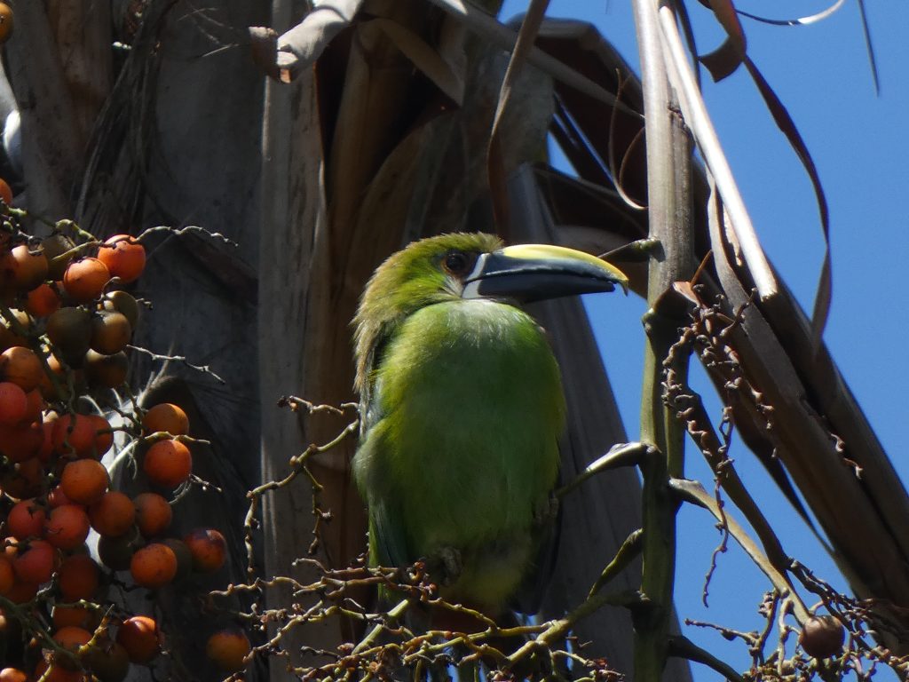
In addition, we have dedicated considerable effort to recording and monitoring the activity of threatened species, whether through the use of camera traps, expeditions, and with the help of community members who know their habitat and care about their conservation.
Red List of the International Union for Conservation of Nature
As part of our work to identify flora and fauna, we prepared a list with the 39 species that are most endangered within the El Tambor area, according to the IUCN Red List (IUCN Red List).
Tremarctos ornatus
Pauxi pauxi
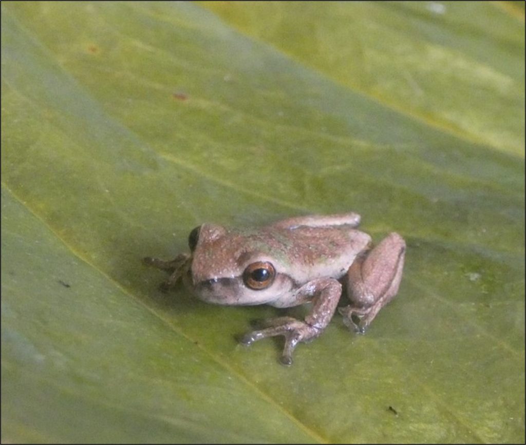
Bolitoglossa orestes
Dendropsophus meridensis
There is still much to discover
New species
Our efforts in identifying the flora and fauna in the El Tambor moorland have allowed us to discover a new species of orchid: The Epidendrum tamborensewhose description you can read here. In addition, we have been able to identify another orchid species whose last record dates back more than 150 years, the Cyrtochilum wagenerii.
Identification of macrofauna
Soil macrofauna is an important ecological variable that allows us to understand the state of the ecosystem and identify problem areas, while also enabling us to verify the results of our restoration activities. To this end, we have created a sampling network to collect macrofauna samples within the cloud forest, pastures, and in the areas we have restored. By comparing the absence or presence of certain insect groups, as well as their abundance, we have been able to determine the level of impact of deforested areas on the forest and the changes resulting from restoration, obtaining very positive results.
Climate
We recently established two weather stations in different parts of the community and trained community members in their operation and maintenance. These stations allow us to monitor various climate variables, such as temperature, humidity, solar radiation, ultraviolet index, wind speed and direction, and precipitation.
Cartography
Use of drones to identify key areas
The use of drones has allowed us to recognize different areas from a different perspective, enabling us to identify critical zones, while also facilitating the planning of our restoration activities.
Maps as support tools
The use of maps has been key to our work, allowing us to make informed decisions in every area we work in. We use maps produced by other professionals who have conducted studies in the area, as well as maps we create ourselves using satellite imagery, aerial photographs, GPS, and other data. We have produced vegetation maps of the El Tambor area, maps of critical areas to be restored, maps of zones requiring special protection, geological maps, and maps of the plantations we have established.